Tuesday, July 30, 2013

And one more thing... Thanks

This whole trip was #1 on my bucket list, so there are some people I need to thank for making it happen. There is a whole lot more to the trip than just riding the bike across the country.  It took a plan and some willing participants.

First, I need to thank Nicholas for taking his summer and spending it with his crazy aunt and uncle (and their dog) in a 23' motor home rambling across the country at a blistering pace of 80 +/- 40 miles a day.  While we have joked about doing this trip with Nicholas for a couple of years, we started talking seriously with him almost a year ago before he had his drivers license.  With some help from his mom and dad, he decided he would give it a try.  Without him, the whole self-supported trip would fall apart.  I hope you had as much fun as we did.

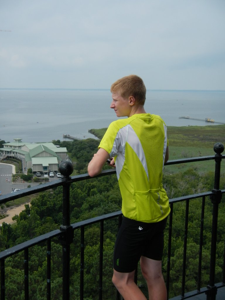
Nicholas did a fantastic job of driving the RV and navigating the route, usually by himself.  He is an incredibly responsible 16 year old.  When we would meet people out on the road and tell them what we were doing, they would always ask "where's your stuff".  Then we would explain that our 16 year old nephew was following us with the RV and then they knew we were absolutely crazy.

I have to thank Beth for going along with such a hair-brain idea and making it happen. There was a lot of discussion about different ways to ride across the country over the past few years.  One thing was made very clear from day one.... we aren't camping in tents! There are ways to ride from motel-to-motel with a car as support, but that takes even more planning, or just sign up with a commercial tour and not worry about any of the planning.  An RV looked like a good way to go, but we have never owned one.  So making the financial commitment to buy an RV just for this trip was a huge decision on her part.

And Beth has also carried the lion's share of day-to-day support doing a lot of laundry, shopping, cooking, checking us into RV parks, and a good share of driving.  So I can't thank her enough.  The next big trip is all yours!

I really need to thank all of our friends and family that came out to meet us along the way, gave us a place to stay, had dinner with us, fed us or just said "Hi".  We really appreciated all the support.

And a special thank you to our neighbors, Clark and Judy, who took care of a problem with our rented guest house.  We had hardly left the state before the air conditioner went out on Memorial Day weekend.  But Clark had it fixed by the next Tuesday and no more problems since.


Monday, July 29, 2013

Epilogue... One more ride

The end of the road...
While we made it to our final RV park yesterday in a thunderstorm, it just didn't feel like we had reached a clear end to our trip.  While Beth was looking at some options for activities while we were here on the outer banks, she found that the road actually ended about 30 miles north of us.  That sounded like a good place to really say we were "finished" with our ride across the USA.

This morning, Beth and I on the tandem and Nicholas on his bike headed north to Corolla to find where the black top ends.  During  the ride we had it all... cool and overcast, sunny and humid, deep puddles from recent rains, heavy rain directly on us and head winds.  It was a good time and we really felt like we had finished our long trip.  4162 miles in all.

While we were in Corolla, we climbed the Currituck Beach Lighthouse.  It gave us a great view of the area and the chance to reflect on our 2 month journey across the country.
Nicholas a couple of flights below me in the lighthouse

Here are the final stats from riding across the country:

48 different RV parks or campgrounds
6977 miles on the RV since we left home
And the riding/running stats:


Saturday, July 27, 2013

Just one more day....

Swamp land in eastern North Carolina
Today we rode a very flat 92 miles from Williamston to East Lake, NC.  The total climbing for the day was less than 400', which rivals any day in Kansas!  Much of the land we rode through was swamps.  We kept looking for the swamp loggers to pop out from from a side road.  They must be around somewhere since we passed several lumber mills along the way.

We have technically made it to the Atlantic ocean.  We passed by Albemarle Sound this afternoon before having the thrill of riding the 3 mile long, 2 lane, Alligator River bridge.  It is the primary access to this stretch of the outer banks, so there was plenty of traffic.  I rode as fast as I could after an 85 mile day into a 10mph headwind, but I wish I could have gone faster!  All of the traffic was very courteous and there was really no problem.   Here is our track for the day.

Draw bridge in the middle of the Alligator River Bridge
That leaves only 40 miles to Kitty Hawk on the outer banks of North Carolina, but two more very long bridges, each about 3 miles long as well.  We plan to get an early start to get over the bridges before the traffic gets too bad.

Personal goals are dropping like flies.  Both Beth and Nicholas have reached their mileage goals whether they ride tomorrow or not.  Nicholas wanted to ride a 1000 miles on the trip and Beth wanted to do at least half of the total mileage that I did.  Here are the current riding stats:


Friday, July 26, 2013

Getting close to the end

Farm Country RV Park .... in a corn field, but very nice
We are really getting close to the end now.  Only two more days of riding left and the last day is less than 40 miles.  We are still one day ahead of our original schedule that we put together back in early May. I am really impressed with the plan we put together and how well it has all gone.

The schedule called for a rest day a couple of days ago, but we decided to ride and use the rest day to make our last 3 days a little more of a relaxed pace... plus it worked out better with finding RV parks and camping.  Finding RV and camping sites in North Carolina has been challenging.  I'm not sure why they seem to be few and far between, but they are.

The weather has been holding up for us.  We had some heavy rain showers during the night before yesterday's ride.  But by morning it was slightly overcast and cool, so a good day for riding.  It was a pretty long day at 95.5 miles with only rolling hills.  We rode the tandem for the first 58 miles and then I finished up alone.  Here is the track from yesterday.  Traffic was a little heavy as we skirted north of the Durham area, but we had very quiet country roads for the most part.

Last night we were in a KOA north of Rocky Mount, NC and it could really use some TLC.  The managers seemed to be clueless about being in the service industry and they are definitely in the running for the most disgusting showers we have found in our 46 nights of camping in RV parks.

Today we rode through the farming flat lands of eastern North Carolina.  Lots of tobacco, cotton, corn, soybeans and peanuts. A scheduled 54 miles turned into 58 with a detour thrown in.  Nicholas missed us when we stopped for a late breakfast in Hobgood.  Beth's text to let him know we had stopped didn't go through because of poor cell coverage.  But we caught up with each other about 15 miles down the road as we would sporadically get messages in/out as we went into and out of cell coverage.  Here is the track for today.

Tonight we are in a family owned and operated RV park near Williamston, NC and it is very nice.  Not sure how well it is doing financially.  It is a little bit of a "Field of Dreams" situation... literally in the middle of a corn field!


Tobacco Fields


Cotton plants in bloom
.

Tomorrow is another fairly long day at 89 miles, but very flat day, finishing with a 3 mile ride across a two lane bridge.... that could be exciting!  Then its only about 40 miles on in to Kitty Hawk on Sunday!

Wednesday, July 24, 2013

A Visit to Mayberry...well Mt Airy, NC, home of Andy Griffith

Yesterday morning saw us once again on the Blue Ridge Parkway with intermittent rain – on with the raincoats, off with the raincoats, repeat.  Leaving the Parkway we descended into the town of Mount Airy.  Mount Airy is the hometown of Andy Griffith and inspiration for everybody’s favorite small town, Mayberry.    

After a much needed stop at Walmart, Nicholas and I continued the ride into Mt. Pilot where we stopped at Greystone RV park.  They get 5 stars for the bathhouse... It would rival the bathroom in many 5 star hotels!  The park is very new and the owners are putting a lot of effort into making it a small, but top-of-the-line RV park.

 Greystone sits below Pilot Mountain and just outside the state park. Pilot Mountain rises more than 1,400 feet above the rolling countryside of the upper Piedmont plateau and has been used as a landmark for north-south travelers since the Saura and Tutelo Native Americans lived in this area.  Here is the track for the ride.


View from Greystone RV Park
Today, Beth decided to take a much needed rest day.  The riding and day-to-day logistics of doing a 9 week self-supported trip is starting to wear us all down a little.  It would be hard enough just to do the 80-100 mile a day of riding, but also having to cook, do laundry, keep the food stocked (and we are eating A LOT!), maintain the bikes, maintain the RV, modify routes based on RV accommodations, etc.  We start early and finish pretty late every day.  But we still get in the occasional game or two of Catan.  Not that we aren't having fun, but it is probably good that we are within 300 miles and 4 days of the finish.  

Today, I started the journey from Pilot Mountain alone while Nicholas followed his typical morning routine of running.  I had made it 46 miles down the road when I ran into a sign on my route that said "No Outlet" I was trying to decide what to do as they caught me in the RV.  It was going to be a 6 mile detour, but a couple of ladies out walking their kids in strollers told me the road was blocked by a gated community and I could just slip through the gate.  Beth and Nicholas took the 6 mile detour, while I risked being arrested for trespassing on the half mile of road in the gated community.  

More views from the Blue Ridge Parkway
At mile 85, we hit another little road block.  Beth had driven ahead and found our route was marked with "No Bicycles" signs.  We checked the maps on the iPad and made a quick adjustment.  Nicholas and I diverted to another nearby highway, but had to put up with significantly more traffic and no shoulder.  We made to the hotel in Hillsborough (just west of Durham) without any problem, but I know I was riding just about as fast as I could.  I logged 99.8 miles on the GPS, but I think I'll just round that up to 100.  Here is the route for today.  


Monday, July 22, 2013

The Blue Ridge Parkway

What a change today was.  The Blue Ridge Parkway is incredible.  Great views of the mountains (many scenic pullouts) and a great road almost totally to ourselves.   The Blue Ridge Parkway runs 469 miles from the Great Smokey Mountain National Park in the southwestern corner of North Carolina up into Virginia.  While it isn't a national park, the land on either side of the highway is owned and maintained by the National Park Service.  The road has limited access, has a 45 mph speed limit and no commercial traffic is allowed.  The few cars we encountered were all careful and courteous as they passed us.  A great change from the unbelievable amount of litter and trash we saw along the roads in eastern Kentucky and Tennessee, even in Daniel Boone National Forest.

One of the viaduct stretches of the Blue Ridge Parkway
We are running into rain almost every day now.  Today we actually had to sit out the rain in the RV for a while due to the low cloud cover and steam. Visibility was less than 100 feet and it simply wasn't safe to ride.

Here is the track for today's ride - 67 miles and 6485 feet of climbing.  That averages 1000 feet of climbing for every 10 miles.  Not a cakewalk by any means. For the folks in Albuquerque, just think of riding up and down Tramway from El Pinto to the Tram stop sign and back.... 6 times in a row.


The woolly calf


Take a look at this cutie!   The parents looked like a cross between a woolly Mammoth and a long horn steer.

Only 6 more days to Kitty Hawk!

Here are the stats for each of us to date:


Panoramic view from the Blue Ridge Parkway ... and it's getting ready to rain again!

Sunday, July 21, 2013

The last state.....

Today we hit the North Carolina state line.  As Nicholas said, "Our 99th milestone."   We spent most of the day in a drizzle culminating in a downpour as we finished the 84 mile ride.  This was supposed to be a shorter day of 67 miles, but due to a road construction detour, our route was expanded adding 17 miles and an extra 1000' of climbing, .  Here is today's track.

Today was much more scenic than the last few days.  However, there were parts of the route the RV could not handle.  In Erwin, Home of Blue Ridge Pottery, part of the route was on a bike path next to the creek.  Then to divert off a major highway (US 19E), Nicholas and Ted rode back roads.  It was a good thing Beth did not take the RV down these routes.  We might still be stuck between the rocks.

I don't think the RV would fit through here...
and yes, this is a road.
Tomorrow we are looking forward to riding the Blue Ridge Highway.
Minneapolis, NC


Saturday, July 20, 2013

I thought we had a shot at making it....

At the Tri-State Marker at Cumberland Gap
I thought we had a shot at making it, but it finally happened... our first flat tire.  Over 4300 miles on 4 different bikes without a flat.  I was really beginning to think we might make it the whole trip without one.

Yesterday we took a "rest" day.  In addition to our usual chores we visited the town of Cumberland Gap and did a short hike on the Cumberland Gap Trail up to the Tri-State Mountain (where Kentucky, Tennessee and Virginia meet). Beth and I were talking and said it was amazing that we hadn't had a ..... yet.  Neither one of us wanted to say the word "flat" knowing it might jinx us, but we both knew what we were thinking.  I guess just thinking it was enough.   Riding in NM, flats are a weekly occurrence, so going 7 weeks without a flat was quite a streak.

View of Cherokee Lake from a scenic overlook
Just a little humid out there....
Today's ride was mostly on the shoulder of 4 lane roads as we transitioned from southeastern Kentucky to eastern Tennessee.  There were still some long hills, but they had been smoothed out by the 4 lane highway construction.  Here is the route from today.

We are spending the night at Davy Crockett Birthplace State Park about 15 miles east of Greenville, TN.

From here we'll ride into the Appalachian mountains and onto the Blue Ridge Highway.
The next 3 days we'll spend in the mountains above 3000' in elevation, so hopefully we'll see some cooler weather.

Friday, July 19, 2013

The Eastern Time Zone and so long Kentucky

The big rolling hills of south eastern KY
We checked off another pair of milestones as we crossed over into the east time zone and left Kentucky behind at the Cumberland Gap tunnel.  The riding has transitioned from the rolling farm land of southwestern Kentucky to the roller-coaster hills of southeastern Kentucky.

Our planned ride on Wednesday was from Hale Hollow State Park to Sand Hill RV Park in the Daniel Boone National Forest.  It was going to be a pretty challenging ride through what seemed to be never-ending roller-coaster hills at 84 miles and about 6600' of climbing... but there was a slight change of plan...

As usual, Beth and I were up early and on the road by a little after 6AM.  The weather was not that hot, but really humid.  The constant up and down of the steep hills is really tough on a tandem.  There was one seriously steep hill that started with a pleasant 16-18% grade climb for about a quarter of a mile.  Beth thought she might fall of the back and I thought the handle bar might slip out of my hands from all the sweat. The climb dropped to something closer to 10% as we approach the top of the mile long climb.... then immediately down again.  By the time we reached Monticello, KY this ride was clearly in the top 3 of tough 50 mile rides what with 4150' of climbing in the hot sticky weather.

Beth took a quick detour to Walmart for supplies while Nicholas joined me for the ride into Daniel Boone National Forest.  The road "leveled out" for a while, but the hills picked up again as we got further into the forest.  When we arrived at the Sand Hill RV park, it was quite the odd sight (and I didn't take a picture).  It looked like something out of a Steven King movie.  The area was mowed and well kept, but with only a lone RV sitting in a back corner of the large park.  The office looked abandoned, no instructions for self-registration, no indication if it was even open at all and no one answered the phone at the number posted at the office.  All of the doors were locked except the women's restroom.  But the water and electricity was turned on at all of the sites   We actually hooked up for a while and considered staying, but in the end decided to move to plan B. It was just a little weird. The Cumberland Falls State Park was another 10 miles down the road.  We called and they had RV hookups as well.  So Nicholas and I rode on making it a 97 mile / 7500' of climbing day.  (here is the route)

Starting the ride out of Daniel Boone NF
Humidity so thick you could cut it with a  knife.
Nicholas had already run 4 miles before unhooking the RV and catching up to us just outside Monticello.  It was really good timing when he caught us.  We were being chased by a dog and we were running low on water to squirt at them.  He then rode 47 miles on the bike and when we got to Cumberland Falls he ran another 4 miles.  Oh to be young!

Luckily we were able to get the laundry done at the campground.  The humid weather and all of the exercise just seems to make the laundry grow even faster.

The ride to Cumberland gap was much less eventful, but very humid.  Still lots of hills in the first 35 miles along the back roads.  The final 20 miles or so was along a 4 lane highway with a big shoulder, so a much more even grade to finish up the day.  (Here is the route).

We'll be taking a rest day here in Cumberland Gap before heading on into the Appalachian mountains and the Blue Ridge highway.

We have entered the land of the Kudzu Vine.  This was a pretty impressive example of how invasive it can be.


Tuesday, July 16, 2013

Really enjoying southern Kentucky

Mammoth Cave
Since leaving the Clarksville, TN / Ft. Campbell, KY area, we have been riding along a designated bike route on the back roads of southern Kentucky near the Tennessee border.  There has been very little traffic and almost all good roads. The riding has been very enjoyable as we wander through the fields and around the lakes. The weather is starting to warm up into the high 80's in the afternoons and the humidity is clearly a factor, but still tolerable.

Yesterday, we took a rest day and visited Mammoth Cave National Park.  We took the "Historic" tour, a 2 mile, 2 hour tour of the most popular part of the cave.  There are 400 miles of known passages in a 7 mile by 7 mile area, so it is mammoth.  I have to say that the parts of the cave that we saw were not all that interesting as caves go.  There were no stalactite or stalagmite formations in this part of the cave.  I think Carlsbad is much more interesting, but it was well worth a visit while we were in the area.

Our camp site at Hale Hollow State Park
We did some rerouting from our original plan and compressed 4 days of relatively short rides into 3 longer days.  This let us finish up today at Hale Hollow State Park which has a really nice campground with RV hookups and tomorrow we will finish in Daniel Boone National Forest at an RV park.

Today was a  pretty hilly, 97 mile ride from Franklin, KY to Hale Hollow. (Here is the route)  The early part of the ride was through Amish farm country with a number of produce stands along side the road.  Beth and I stopped at a "self-service" stand and bought some tomatoes and corn.  We looked a little funny with a plastic sack with 3 ears of corn hanging from the front handle bars for about 35 miles.  We also took our second ferry ride in Kentucky crossing the Cumberland river at Turkey Neck bend.

Quilt block on a barn
We have seen a number of barns with quilt block patterns on them since we have been riding in Kentucky.  We have seen them in other states, but there are no shortage of barns with quilt blocks in this area.

It is hard to believe that we are now at the end of 7 full weeks on the bike, with over 3200 miles logged and less than 2 weeks to go!... and we are still on schedule!

Here are the stats from the trip so far.  We've added Nicholas' running miles since he has been on a training schedule since we started.


"Self-service" roadside produce stand, all on the honor system
Crossing the Cumberland river on the ferry at Turkey Neck Bend

Sunday, July 14, 2013

The license plate quest takes a new turn

A very peaceful country lane in southern KY
We got a little wet today on our ride from Clarksville, TN to Franklin, KY, but it was a really pleasant ride.  We were riding the very rural roads with miles of corn, soy beans and tobacco fields.  The roads were a mix of paved country lanes and very lightly traveled secondary highways.  Only one little routing problem when the road turned into someone's driveway.  Even Google maps showed it as a road, but the locked gate was a little bit of a problem.  We had to back track a mile or so, but no big deal.  Just another text to Nicholas on where to meet us to avoid the dead end.  Here is today's track.

The owners and staff at the 431 Grill in Adairville, KY
On to the license plate saga.  We had found a license plate along the side of the road in every state we have ridden through up to Illinois.  But with only 140 miles of riding in Illinois our luck ran out.  Just to hedge her bets, Beth found an Illinois plate in an antique shop in Goreville, IL and bought it.  In the past when she had given up and got a license plate from a junk yard in Kansas, then we found one not too long afterward.  Not so in Illinois... the streak is over.

However, the quest for license plates continues.  Today, we stopped in Adairville, KY for a mid-morning breakfast at the "431 Grill".  While we were ordering, Beth noticed that there were Kentucky license plates on the wall.  Just on the off chance, Beth asked our waitress if they would be willing to sell her one of the plates.  She asked twice and then  one of the owners came over and talked to us.  The owner went out and looked in their garage but didn't have any.  The ones on the wall were old police plates from when her husband was on officer and they didn't want to and probably shouldn't sell any of them.  In the meantime we told them about our trip; trying to collect a plate from every state we visited; and that we frequently get a late breakfast at the local diner in the towns we pass through. As usual, they all thought we were nuts.

When I went to pay the bill, her husband came out and gave us a license plate off the wall.  It wasn't a police plate but an older plate that the design hadn't been used for very long so would be hard to find.  That just made Beth's day.  So many thanks to the folks at the "431 Grill".  Oh and breakfast was great too!  Stop by and visit if you are ever in Adairville.


Saturday, July 13, 2013

Moving right along... Illinois, Kentucky and Tennessee (just barely)

Somebody had a good since of humor...
this was definitely a bump in the road.
We have been making good progress over the last few days.  The weather has been exceptionally mild for this time of year with the highs in the mid-80's, a nice breeze during the day and the humidity is very tolerable.  We can only hope this continues for a few more days.

After spending the night in Murphysboro, IL yesterday, we put in a long day in the hills of southern Illinois to Cave In Rock.  It was 100 miles and over 6400' of climbing which was a pretty challenging day. (here is the route) 

We hit a little construction projection not long after we left the state park that had completely closed the road.  It was only a quarter of a mile or so long and they let us walk the bike through. I told Beth to send a text to Nicholas to meet us in Anna, IL to avoid the closed road.  The only problem was we weren't going to Anna... we were headed to Goreville. It is another long story why I thought we were going through Anna.  And to be real honest, after 6 weeks and 30-some routes, we can hardly remember the starting and finishing towns on any given day. 

We were riding on back roads and only occasionally saw road signs and the only route map we carry with us is on the Garmin 800 bike GPS which is very small and can be difficult to read.  It is great as long as you don't have to deviate from your planned route.  We finally saw the sign for Goreville and luckily we had cell service to download a better map.  So another text to Nicholas to make the 16 mile drive to Goreville.

While waiting for Nicholas, we stopped for an early lunch in Goreville at Delaney's restaurant.  They cater to the TranAmerica bike route crowd... Believe it not there are quite a few people that do ride across the USA.  Delaney's provides free desert to cyclists doing the ride.  While we were there we exchanged stories from the road with two guys from Nebraska doing it the hard way, packing all of their stuff on their bike and camping their way across unsupported, what is called  "trekking".  We have met quite a few people along the way trekking across the USA, mostly heading from east to west.  We have only met one other group of cyclists who had RV support following them along the route.  For the most part, it is the truly crazy trekkers with fully loaded down bikes that we meet on the road.  I'll take the RV... I'm not much into camping, especially for the 2-3 months it takes. And Beth says there is absolutely NO WAY! It is hard enough just to ride the 4000 miles on a bike without 50 pounds of stuff hanging on it and then sleeping on the ground in a tent most nights.

Ferry from Cave In Rock, IL to Kentucky
We ended up in another really nice Illinois state park at Cave In Rock.  We have to give Illinois two thumbs up on their state parks and they seem to be very well kept secrets.  Both parks we stayed in were nearly empty.  Cave In Rock is right on the Ohio river with free ferry service into Kentucky.  I left early to take the ferry and then met up with Beth and Nicholas about 45 miles later.  Then Beth and I rode the tandem for a while and then Nicholas finished up with me.  It was an 89 mile day, but fewer big hills, so we made a little better time.  And we crossed 2 state lines in one day... Kentucky and Tennessee!  Here is the track for the day.

Our final stop for the day was Clarksville, TN where Beth's older brother, Jeff and his wife Yolie live.  Although they kindly offered us a bed for the night, we needed a RV park to take care of some necessary chores (dumping and filling tanks).  After checking into the Clarksville RV park, getting showers and doing some laundry, we had dinner with them.  We enjoyed our visit with them and Mo, our beagle, really enjoyed exploring their backyard.  Thanks for the venison steaks and sausage.

Tomorrow is a relatively short day (about 59 miles) to Franklin, KY.  We still have more laundry to do, need to restock the food supply and do some bike maintenance.  So having a short day will give us a chance to catch up on things.  Then we'll take a rest day to go visit Mammoth Cave National Park about 40 miles north of Franklin and tour the cave.

Here are the current riding stats:
(down to less than 1000 miles to go)


With all of the climbing we have been
doing, you have to get a really good
down hill once in a while

Thursday, July 11, 2013

Crossing the Mississippi, playing with the semi's

Bridge across the Mississippi
Today was another milestone on our trip across the USA, crossing the Mississippi.   It was pretty hairy getting across the bridge.  I had expected that there would be a shoulder, sidewalk or bikepath since this bridge is used on the Transamerica bike route... OH NO.... two narrow lanes and full of trucks going into and out of Chester, IL. Then I made the mistake of routing us through downtown Chester where 3 out of 4 vehicles are semi's.

Anyway, we survived, but not without a few close calls.

Yesterday we woke up to thunder, lightning and rain in Steelville, MO.  This seemed to be pretty mild compared to the weather that was passing through Indiana and Ohio or the flash flooding in Colorado Springs right where we stayed just a couple of weeks ago.

We watched the weather radar on the iPad until it looked like the worst had passed.  At about 10AM, I headed out for Farmington, MO.  I rode in very light rain for about the first hour and then the weather cleared up, eventually getting to hot and muggy.  It sure felt like a slog for the 68 miles.  I think taking 4 days off the bike was probably 2 day too long.  The legs were feeling the effect of the previous day's 5400' of climbing on the hills.  Here is the track for Wed, 7/10.

Early morning ride toward the Mississippi
Today was a near perfect morning for a ride.  Our route took us along a number of very quiet backroads through the Ozark hills, then down to the Mississippi river bottom farms.  Beth and I road the tandem the first 57 miles through the hills and into Illinois.  Then Nicholas rode with me through the Illinois river bottom farms and into Lake Murphysboro State Park.  The weather was really nice with relatively low humidity and the temperature in the low 80's.  Here is the track for today's ride.

The state park has RV camping with electric hookups at each site with water and waste dump in the park.  It is a really nice park with only about 8 of the 54 sites occupied.  Almost like having our own private park to stay in.

Tomorrow is off to the much anticipated location of Cave In Rock, IL.


Chester is the home of Popeye
creator, Elzie Segar

Mississippi bottom land farms
Nicholas riding along the
Mississippi levy