Thursday, July 16, 2015

West Glacier NP and then Homeward Bound

Monday, July 13th – West Glacier

Interesting sign as we ride up the west side of Glacier NP

Today was a transition day as we moved camps from the East Glacier to the West Glacier area.  Because of the height and length of the RV we were unable to drive across the Going to the Sun road and instead had to drive around the park on Highway 2.   Once we found our RV park, we stocked up on groceries and did laundry before heading into Whitefish for some sightseeing and dinner.

Tuesday, July 14th
Our ride this morning was in a “less-traveled” section of West Glacier.  Leaving from the Apgar Visitor Center, we took gravel roads through the southwest side of Glacier on “The North Fork in the park road”.  The sign posted at the beginning of the ride says it all.  This area suffered from a massive fire about 13 years ago and it was interesting to see how the forest is rejuvenating.   We saw only one car driving on the road and three parked at Camus Creek.   At that point the road was closed to motorized traffic.   At 12 miles we turned around and headed back.  We passed two other bikers on our way back... a really quiet and peaceful ride in the wilderness.

A buck that was hanging out along our ride
After returning to the Visitor Center we rode the free shuttle to Logan Pass.  After riding up the other side of the mountain we wanted to see how this side compared.  The last 10 miles up to the pass is an engineering marvel of carving a road into rock for the 3000' ascent to Logan Pass. Most of the organized bike groups ride up to Logan pass from the West Side and then down to St. Mary’s.  Both sides are impressive and beautiful.  But compared to our morning ride, the “Road to the Sun” is like being in Disneyland…cars and shuttle buses everywhere.

Weds., July 15th – Time to Head Home
It’s been a great time traveling around the northern plains states and seeing some areas we haven’t visited yet but it is now time to head home.  We are both looking forward to a little more space!  So it was time to pack up once again and this time head south.  We drove to Missoula, found a city park, had lunch and fooled around on the river trails before driving into Idaho.  We are camped just outside of the Salmon, ID along the Salmon river.
Total Bike Miles – 9.5

Thurs., July 16th  - Idaho Falls and on to Ogden, UT
The falls in Idaho Falls

After the night in the fishing campground, we headed on to Idaho Falls.  We dropped the road tandem and took a quick tour of the “greenbelt” in downtown Idaho Falls.  After the ride we had a really nice lunch at the Snow Eagle Brew and Grill.  The food here was really good even though it was rated below several chain restaurants in the area.

We moved on to the Ogden, UT area to the Willard Bay State Park Campground.  This is a nice state park very close to I-15 with full RV hookups which is really good since it was 90 degrees when we pulled in at 5:30 PM.

This will be the last post as we slog our way back to ABQ and real life for a while.
Total Bike Miles - 12 miles


Sunday, July 12, 2015

Glacier National Park... We finally made it!

Thursday, July 9th
Rattle snake along the highway that wanted to bite Beth
Our morning ride took us from Valier to Cut Bank for a total of 61 miles round-trip.  The Montana drivers on this stretch of road, what few there were, were not only courteous but friendly.   Traffic was not an issue but who knew we would have to watch out for rattlesnakes.   Because last night was very cool, they must have been crawling onto the roads to warm up.   As we passed one climbing a big hill (going slow), we scared it and it curled up and started rattling!  Needless to say the stoker added a little extra energy to the pedals.   Ted had not seen it so he went back to take a picture.  All the others we saw were road kill including this one on our return trip.

Cut Bank is the location where Lewis and Clark and some Blackfeet were involved in an argument over guns and horses.  The story varies as to whom was at fault based on which side tells the story.   Both sides agree that it resulted in the death of two young Blackfeet. 

We continued our visit of Diners, Drive-ins and Dives with a stop at Big Sky Café  (the #1 restaurant for Cut Bank per Trip Advisor) for a mid-morning brunch before returning to Valier.  The staff were friendly and asked about our ride.  They made us feel like real slackers when they said a group of 6 cyclists pulling canoes with their bikes had been in the day before.  They are pedaling and paddling all the way to the Gulf of Mexico.

July 10th – Glacier National Park
Today we drove to the East Entrance of Glacier National Park. This park has been on our "Must Visit" list for quite a while and we have finally made here. We stopped at Two Medicine Lake for a 4 mile hike.   We originally planned to hike further, but the flies were really bad and Beth was unwilling to cross the swinging bridge over the river. The sign indicating weight load was one person only and the missing slats did not do anything to alay the anxiety.  If we were on “Amazing Race”, she claims she could have done it.  We did hike up to Astoria Falls.  Then it was time to head to our campsite at St Mary’s.

July 11th – Going to the Sun
We were off to an early start to ride to Logan Pass on the Going to the Sun Road.  Scenery was spectacular despite the clouds and cool weather.   Unfortunately the road on the east side of the pass is under construction and we had to wait both ways for access to the two mile stretch of one-lane road while dodging cars and semi's with asphalt.  This seriously impacted our “wheee” coming down the 2000’ descent.

July 12th – Many Glaciers
Many Glaciers Hotel on Swiftcurrent Lake

We had serious winds all night and into this morning with cloudy skies and threats of rain.   We started off with breakfast at a real “Dive” Johnson’s café.  We would not recommend anyone eating here – the food was awful and expensive.  However, the rest of the day was absolutely fabulous.   We started with a visit to the Many Glaciers Hotel which is celebrating it’s 100th birthday.  The deck overlooks Swiftcurrent Lake and the views were great.  Then we set of on a 7 mile round trip hike up the southern side of Lake Josephine.  The trail took us  past small waterfalls and on to Grinnell lake.  We also visited Hidden Falls which feeds Grinnell lake.   The weather improved throughout the hike but stayed cool enough for us to enjoy being outdoors and with enough wind to keep the flies and mosquitoes at bay. 


 Grinnell Lake being fed by glacier melt
On the way back we were fortunate enough to see a mother moose and her calf.  They actually appeared to be posing for our pictures.  We finished up with a late lunch at Many Glaciers Hotel before heading back to Saint Mary’s Campground for our final night on the east side of Glacier National Park.
Moose with her calf in Lake Josephine

Wednesday, July 8, 2015

Finally found Lewis and Clark...

Sunday, July 5th  - Fort Peck Reservoir

Camping spot at Fort Peck Lake
Today was a rest day from riding.  We drove to Fort Peck Reservoir.  The lake was formed by the largest hydraulic earth filled dam in the world.  The dam was built in the 1930’s under the supervision of the Army Corps of Engineers as part of work projects developed to help provide jobs during the depression.  The area is still managed by the Army Corps of Engineers.  The lake shore, at 1520 miles, are longer than the California coast and are a great place to fish and boat.  Campgrounds, most without water or electricity, are found around the lake.  Most are accessible only through unmaintained roads and we were warned “If you see a single raindrop on the back roads near Fort Peck, head back immediately.  These roads tend to wash out easily and getting stuck is a real possibility”.   With that in mind, we found a camping spot just off the main road but still next to the lake.  The high temps of the last two days were gone and with the breeze, it was actually a little chilly in the RV.

At the bottom of the dam overlooking the Missouri River, is the Fort Peck Interpretive Center and Museum.  The center features exhibits on Fort Peck Dam construction and homesteading, wildlife of the CM Russell National Wildlife Refuge (which surrounds the lake) and paleontology including a cast of Tyrannosaurus rex.  This is a free museum with excellent exhibits.  Tours of the power plant are also available, although we skipped that.

Monday- June 6th – Beaver Creek Park – Havre, Mt
Lots of hay in this area along with a lot of wheat
A 42 mile loop ride started our day.  Because of the drop in temps, we actually started out in jackets.  Riding was quite pleasant for the first 15 miles.  We had to ride the next 15 miles on US highway 2 from Nashua to Glasgow. Hwy 2 is the main east-west highway in Northern Montana and in a lot of areas there is no other paved road.  So, while not super busy, it does have a fair amount of semi’s and RVs pulling cars or boats or both… and the speed limit is 70mph on a 2 lane road with no shoulder.   Montana drivers are not nearly as courteous as North Dakota drivers.  We had several cars within 3’ of us going 70+, including an 18 wheeler and a truck pulling a boat.  If you haven’t experienced it, getting hit by the air pressure front from a semi going 70 mph is pretty scary.   You nearly get blown off the road and then immediately get sucked back in toward the trailer.  Hwy 2 is designated by Adventure Cyclists of America as the “Northern Tier Cross-America Route” and is the suggested travel route across most of Montana.  Sure glad we did not take that route 2 years ago.  Regardless we made it back to the RV safely.  

After the ride, we packed up and headed out.  Again we saw a change in geographic make-up as we moved further west.  Havre is surrounded by plains but just south are the Bear Paw Mountains.  Approximately 20 miles south of Havre is the biggest county park in the US, Beaver Creek Park at 10,000 acres.   How could we not travel into it to spend the night?  We camped by Bear Paw Lake in a campground run by Mt. Fish, Wildlife and Parks.  Again we have the campground almost to ourselves, with only one other camper across the lake.  

Riding in Beaver Creek Park
Weds., July 7th – Havre to Great Falls, Mt
Just a short 17 mile ride through the park and then into the RV to head to Great Falls.  We had planned to ride to a ski area south of the park, but just south of the park was a pretty good size herd of free range cattle.  This was a pretty narrow canyon and the cattle were pretty skittish of the bike.  It wasn’t long before we looked like a one bike cattle drive.  Plus there were a couple of bulls butting heads alongside the road.  Progress was slow, and visions of a cattle stampede from the cowboy movies started to become a very real possibility, so we just headed back to the RV. 

It quickly clouded up and rained off-and-on for most of the day but this didn’t prevent us from stopping in Loma for lunch at “Ma’s Café”.  Loma is a census-designated place – had to google that.  It simply means there is a concentrated number of people in the area, but it’s not even an unincorporated town.   Ma’s gets points for billboard advertising which drew us and obviously others in.  The food was typical café style and sold a potpourri of other items, plus it’s a casino… but just about every gas station in Montana is a casino.

2K's Kafe - #2 rated place to eat in Great Falls
From Ma’s we continued south the Great Falls.  After all this time in the RV, we decided it would be nice to spend the night at a hotel.  Dinner was at Ernie and Bert’s, not of Sesame Street Fame, but a very nice brewpub - # 1 of places to eat according to Trip Advisor.

Thursday, July 8th – Valier, Mt
We enjoyed a rambling, easy 27 mile ride through Great Falls down the River’s Edge Trail.  The trail runs along the Missouri River and provides easy access to spectacular views of the river, dams, waterfalls and Giant Springs State Park (yes, it has a giant spring flowing directly into the MO river).  Along the way we stopped at 2K’s Kafe for breakfast - #2 place to eat in Great Falls according to Trip Advisor.   It seems a little like we are visiting “Diners, Drive-ins and Dives” with an emphasis on “Dives”. We’re pretty sure the Fire Marshall would not approve of the 6 or 8 things plugged into one outlet with a 3-way plug and an extension cord.   Breakfast was quite good and the service was quick and friendly.

Falls and damn on the MO river at Great Falls
After a stop at a bike shop and Walmart to stock up on groceries and essentials, we drove north to 
Valier, MT to a town run RV park.  We talked to the camp manager and he said that he had 55 RV’s in 51 units in the park over the 4th of July weekend…Hard to believe since there are 6 campers here now and Valier is literally in the middle of nowhere.  The campground is not even on Google maps.  Our campsite is right next to Lake Frances.  Temperatures are rising, again, so it’s nice to be able to hook up to electricity for air conditioning.

 
Finally found Lewis and Clark.   "Damn, where did that dam come from!"

Saturday, July 4, 2015

Montana Badlands

Friday, July 3 – Theodore Roosevelt National Park
Overview of Makoshitka SP in eastern MT.
Rare shot over Beth's shoulder...

We started the morning off riding the 27 mile park loop in the opposite direction.   Again we saw plenty of wildlife including a pair of pronghorns, several male bison alone along the road and a herd of bison with calves in one of the grassy areas.

After our ride it was then time to move on, crossing into Montana.  We stayed at a “Cowboy Garth” campground  (click the link to read about the Cowboy Garth reference) in Glendive.   An RV park was here in the past, then the land was bought and an Astoria hotel built.  However, behind the hotel, Larry was working on reconstructing the RV park.  Electric, water and sewer hookups were available but we were one of only four campers there.

Saturday, July 4 – Makoshika (ma KO she ka) State Park
"Lonely bike" shot
We have Beth’s Mom to thank for finding this park.  It was in Country magazine (a subscription from Mom) as a “Hidden Gem”.  Just outside of Glendive, the park is considered one of the most impressive badlands areas in America and the largest state park in Montana.  Ten species of dinosaur fossils have been discovered here, including Tyrannosaurus rex.  This park is considered the eastern entrance to the Montana dinosaur trail.

We spent the morning riding the gravel roads (15% grade in some areas) and hiking to fabulous viewpoints.   Pictures just can’t convey what the eye sees.  As we rode back into town from the park we got to join the last 100 yards of the local parade down the mainstreet of Glendive..  What a glorious way to spend the 4th of July.

Thursday, July 2, 2015

Back along the Lewis and Clark Trail

Hazy wet ride along the Missouri River in ND
Tuesday, June 30
Today started with a wet ride.  It was just spitting when we left Cross Ranch SP but it turned into a rain off and on for the 42 mile loop.   The first 15 miles were the dirt river road running along the Missouri River so we took the fat tire tandem.   Having left the flat plains of eastern ND we were happy to have some rolling hills to ride.

Then on to Fort Abraham Lincoln SP outside of Bismark.   We journeyed into Bismark, the capital of North Dakota.  We had dinner at an Irish pub (ranked #2 in Bismarck by TripAdviser) and it was good food and gave us a chance to walk around downtown. 

Fort Abraham Lincoln is where Custer rode out for his fateful last stand.  The North Dakotans are quick to inform you that he was in good health when he left ND.   Hope our luck in Montana is better than his at Little Big Horn.

Theodore Roosevelt NP
Wednesday, July 1
We rode downriver from the state park, following the Missouri River to Sugar Loaf Recreation area and back. Beth scored both a motorcycle and a auto ND license plate on this 25 mile out and back ride.   Weather was great, but still a little hazy from the smoke blowing in from Canadian forest fires.

Then onto Theodore Roosevelt National Park in Medora, ND in the badlands near the Montana boarder.   We are staying in the South Unit at the Cottonwood campground... and yes, there is plenty of cottonwood floating around the camp site.   Again a dry camp with no electrical service, but water is available if needed.   

Bison who was a little close for comfort... giving us the eye
Teddy Roosevelt established two open range ranches here; one with partners and one his own operation.  Elk Horn became his principal residence, a place he could live the "strenuous life".   By spending time here, he developed many of his conservationist ideals.  

Thursday, July 2

We rode the 36 mile loop of the south unit.   
We are definitely back in the west now, with buttes and great rock formations.  We felt a little like we were back home in NM, but way too much green grass for that.   

We were lucky to see a variety of wildlife including prairie dogs, feral horses, mule deer and bison.  One of the bison was so close to the road we were a little worried he might come after us as we were climbing a pretty steep hill and he would have had no trouble running us down.  
A field of  Canola.  We have seen huge fields of the yellow flowers and Beth finally Googled it to find that ND is the largest producer of Canola in the US.

Monday, June 29, 2015

#29... North Dakota (Obama's 50th)

Saturday, June 27 – Red River State Recreational Area
Grand Forks, ND
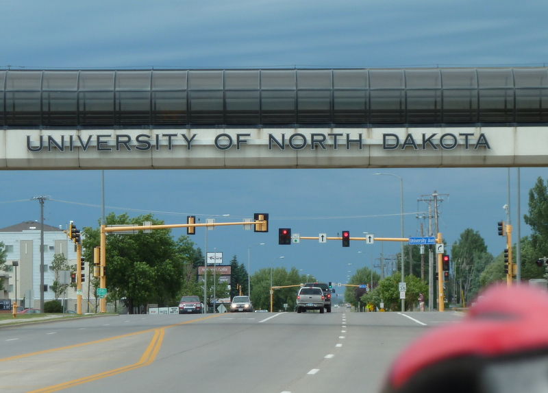
We left Itasca State Park and headed out to Red River SRA.  Red River SRA is part of the Greater Grand Forks Greenway and is located in the city of East Grand Forks MN on the banks of Red River of the North and Red Lake River.  We were able to get a non-electric site for the night.  We took a bike ride around the Greenway in both MN and North Dakota, checking off another state (#29) on our list with our 3rd two-states-in-one-ride on this trip.   We rode through the University of North Dakota which has a beautiful campus. Total bike miles  – 22.    

Shortly after our ride, a thunderstorm with tornado warnings rolled in.  Despite some heavy rain, thankfully no tornado.   I would really hate to see what a tornado could do to a RV campsite.  After the rain let up we took a short walk to dinner at the Blue Moose on the river front.  With the park in downtown Grand Forks, there was easy access to a lot of options.

Rainbow after the storm... and a guy with a full sized
 diesel tractor to pull his 5th-wheel
Sunday, Jun 28 – Graham’s Island State Park, Devils Lake, ND
Another morning of driving took us into North Dakota to Devils Lake, ND.  We needed to take care of laundry and shopping so made a stop in town before heading to Graham’s Island State Park. Unfortunately we ran into one of the last remaining bastions of “Blue Laws”.  ND still enforces a wide of array of retail sales restrictions on Sunday, so much so that most stores don’t even open until noon… Not even Walmart!!!  But by the time we had finished up laundry, it was past noon and we could stock up before heading to our camp site.

Devil’s Lake is ND’s largest natural lake and the second largest body of water in ND.  It is well known by sport fishermen for walleye and northern pike.  Too bad we don’t fish. But there were plenty of fishermen around.  We saw some of the largest RV parks we have seen and plenty of fishing boats in the area.  Grahams Island has close to 200 RV spots and they were completely full on Saturday night, but we had no problem getting a spot on Sunday.

Monday, June 29 – Cross Ranch State Park, ND
Humid, hazy morning

The morning started off with a tough 42 mile out and back ride.  It was very flat riding with humidity in the 90’s and 10 – 20 mph wind in our face for the first half of the ride.  The humidity was so thick the sun was just an red ball in the sky.  Not a lot to see, we were either on levy roadways which run through the lake or in farm country.  Our original plan was to ride around the entire lake, 65 miles, but with the stiff headwind the last 15-20 miles back to the RV could have been a very unpleasant slog so we road to the town of Minnewaukan (or what’s left of it) and back.   

It was quite interesting to see how much higher the lake was than in the past.  Because the lake is endorheic (Google challenge) the water level can rise and fall dramatically and is more saline than most typical fresh water lakes.  The lake has risen 25 feet in the last 10 years.  Entire barns were in the water. Over 300 homes and 70,000 acres of farmland have been flooded.

After our ride, we moved on west to Cross Ranch State Park, ND which is located along seven miles of the last free-flowing, undeveloped stretches of the Missouri River about 25 miles north of Bismarck.

Abandoned house that is being taken over by Devil's Lake

Friday, June 26, 2015

Off to the Headwaters of the Mississippi

Mississippi flowing from Lake Itasca
Thursday, June 25th  – Itasca State Park
After the night at Birch Lake Forest Campground we decided to bag the Lake Woebegone trail.  We had seen the trail and much of the local roads (beat to crap) on the way to the campground. We are getting a little tired of the rails-to-trails, cornfields and beat up roads so we decided to head 100 miles north to Itasca State Park and the head waters of the Mississippi River.  We thought that we should be there fairly early to get a campsite since every Minnesotan we talked to suggested going to this park but indicated that it was quite popular and getting a camping spot in the summer could be tough. 

By arriving early we were able to get a campsite next to Lake Itasca but checkout for the current occupants was not until 4 pm.   We parked by the visitors center and rode to the Mississippi headwaters at the effluent of Lake Itasca, then on around the Wilderness Trail for a total of 16 miles.

Mississippi crossing not far from the headwaters
Itasca State park includes not only the beginning of the Mississippi River but a large tract of Minnesota’s remaining old growth red and white pine forest.  Established in 1891, Lake Itasca is Minnesota’s oldest state park. 

Friday, June 26th- Itasca State Park
Our goal today was to head to the home of Paul Bunyan and Babe the Blue Ox, as well as, the curling capital of the US – Bemidji, MN.  Our out and back ride of 69 miles followed the “Great River Road” (car) and “Mississippi River Trail” (bike) and was our longest ride so far.  Scenery was different with mostly pines and birch trees.  Much of this area is state park, recreation area or nature preserve so traffic was light although the roads had plenty of cracks.  But the day was beautiful and the ride was quite manageable.

Paul Bunyan and Babe
In downtown Bimidji in a park by the lake, we found the Paul Bunyan statue which is 18 feet tall and weighs 2 ½  tons above the footings.  Babe is constructed of wooden ribs covered with canvas.  At one time Babe’s eyes blinked and smoke came out of his nose.  The statues are on the National Register of Historic Places as official cultural resources worthy of preservation.  Why??  We don’t know… very folk art looking and clearly won’t be in the Louvre next to the Venus de Milo.


P.S.  Beth finally scored her first license plate of the trip… Minnesota!